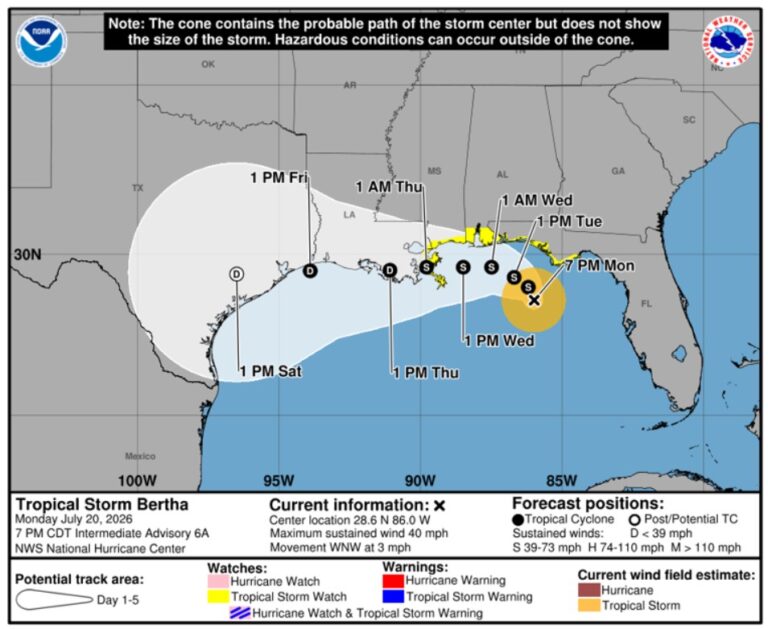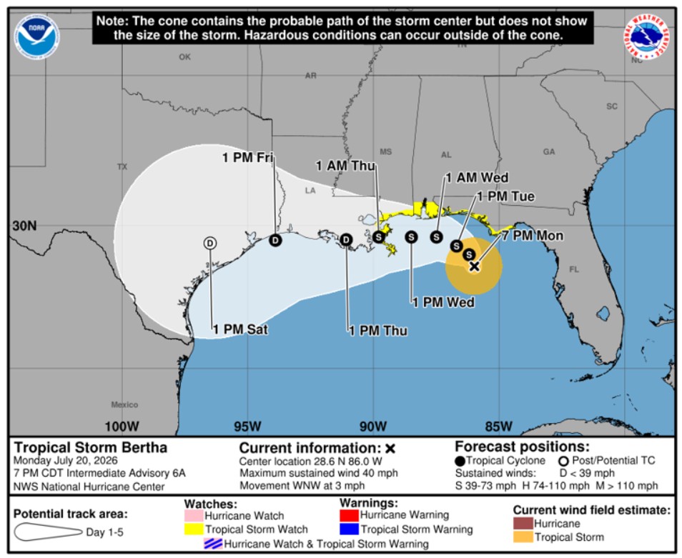
Forecasts warn of flooding as Tropical Storm Bertha forms in the Gulf. – Federal forecasters warned that Tropical Storm Bertha was “stationary” on the evening of July 20 and that it would produce torrential rainfall, coastal flooding, and tropical storm conditions to several areas of the northern Gulf Coast in the days ahead.
The National Hurricane Center reports that on July 20, Bertha, the second named storm of the Atlantic hurricane season, strengthened from a tropical depression.
As of the hurricane center’s 10 p.m. CDT advisory, the storm was roughly 215 miles southeast of Mobile, Alabama, and 140 miles south of Panama City, Florida. The highest sustained wind speed in Bertha was 40 mph.
Bertha is predicted to move close to or around the northern Gulf Coast over the next few days, with forecasters predicting a gradual west-northwestward or westward track. Up to July 21, there may be some more strengthening.
According to the hurricane center, tropical storm watches were in place throughout the Gulf Coast, where strong winds, a lot of rain, and hazardous surf conditions could develop late July 20 or early July 21. From the Alabama-Florida line to the Mississippi River mouth, a storm surge watch was in force.
On July 21, forecasters warned officials and citizens in Louisiana and Texas to keep an eye on the storm’s development since “additional watches or warnings could be required for portions of that area.”
Potential flooding
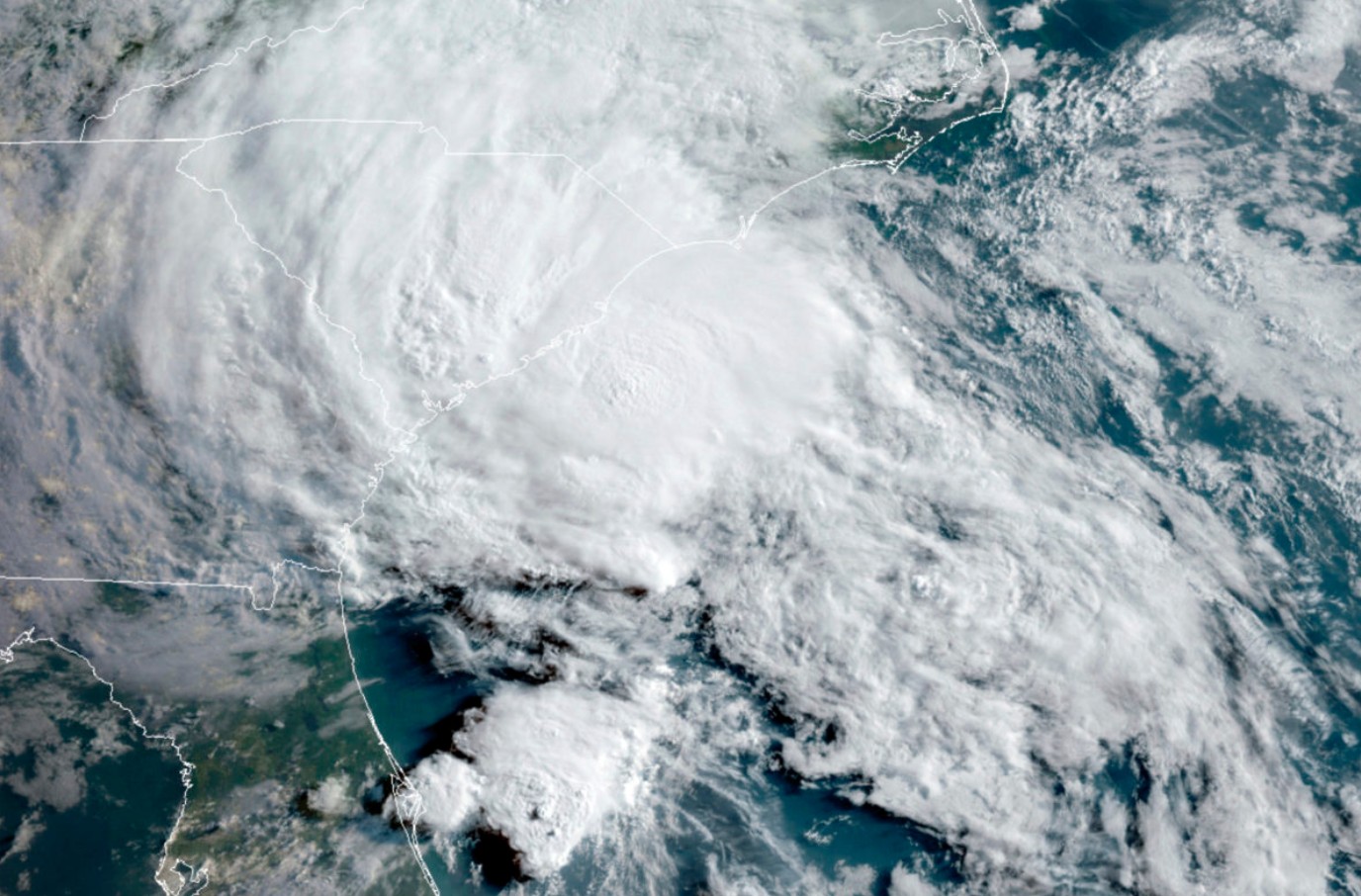
Bertha is “expected to produce rainfall amounts of 2 to 4 inches with locally higher totals around 8 inches through Friday along the Gulf Coast and adjacent inland locations from western Florida to the Middle Texas Coast, including southern portions of Alabama, Mississippi, and Louisiana,” according to the hurricane center. Flash floods could result from this storm, particularly in metropolitan areas.
“While rainfall will be welcome across portions of the Florida Panhandle due to an ongoing drought, the flooding risk can be increased due to dry soil,” stated AccuWeather meteorologist Alex DaSilva in an online post. Instead of immediately absorbing the water, this hard, dry earth may let it flow off.
Given the geography and recent substantial flooding that happened throughout the region, AccuWeather warned that there will be increased worry for flash floods if heavy rain moves farther west into the Texas Hill Country.
This is the second storm in what should be a calm year.
The storm forms in the Gulf approximately one month after Tropical Storm Arthur.
Due in major part to El Niñoo’s storm-snuffing effects, forecasters predict “below-normal” activity levels during the 2026 Atlantic hurricane season.
According to the National Oceanic and Atmospheric Administration’s seasonal outlook, eight to fourteen named storms are anticipated, with three to six of them developing into hurricanes.
Based on weather data from 1991 to 2020, an average year has roughly 14 tropical storms, seven of which develop into hurricanes.
About the Author